
Every morning, millions of people around the world tap open a weather app to see a strip of sun-and-cloud icons stretching ten days into the future. It’s one of the most consulted forecasts on the planet — yet one of the least understood. How is that little row of symbols generated? How much should you actually trust what it says about next Thursday? And how can you read a clima de 10 días intelligently instead of taking it at face value? This guide answers all of those questions.
What Exactly Is a 10-Day Weather Forecast?
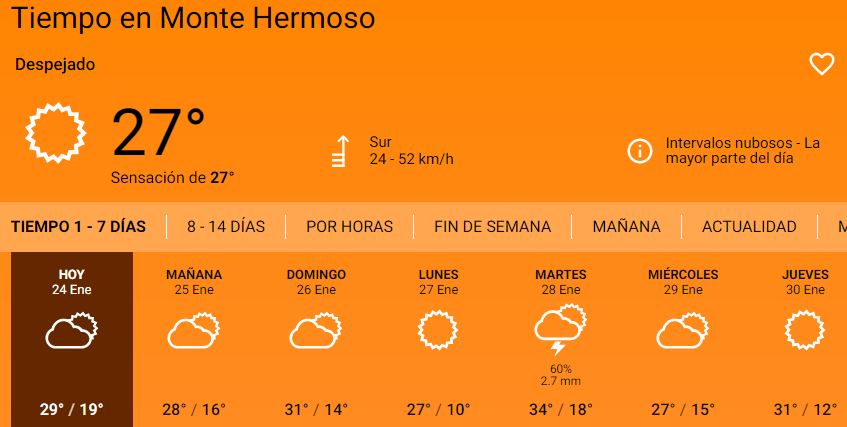
A 10-day weather forecast — known in Spanish-speaking countries as the clima de 10 días — is a meteorological prediction that attempts to describe the temperature, precipitation, wind, humidity, and general atmospheric conditions for each of the next ten calendar days at a given location. It represents the practical outer edge of what modern science can reliably forecast.
But why ten days specifically? The answer lies in a concept physicists call the theoretical limit of atmospheric predictability. From the physical laws that govern how air moves and how atmospheric conditions evolve, meteorologists have established that the atmosphere “forgets” its current state in approximately 14 days. This means that no matter what the weather is doing right now, within a fortnight the current conditions can evolve in virtually any direction. Fourteen days is therefore the hard ceiling beyond which forecasting becomes little more than educated guessing.
“Our methods of weather prediction are still imperfect, so the real practical limit sits a little lower than the theoretical one — at approximately 10 days. That is exactly where this number comes from.”
This is why ten days has emerged as the gold-standard planning horizon: it is long enough to be genuinely useful for trip planning, event scheduling, and agricultural decisions, while still retaining enough physical grounding to provide meaningful — if imperfect — guidance.
Inside the Machine: How 10-Day Forecasts Are Generated
Modern weather prediction is an astonishing feat of computational science. The process that turns raw atmospheric observations into the tidy icons on your phone involves several interconnected systems operating continuously, day and night.
Step 1 — Collecting the raw data
Before any forecast can be made, meteorologists need to know what the atmosphere is doing right now. This data comes from an enormous global network: tens of thousands of surface weather stations measuring temperature, pressure, humidity, and wind; radiosondes (weather balloons) released twice daily from hundreds of sites worldwide; thousands of commercial aircraft equipped with sensors; ocean buoys and ships; and crucially, satellites. NOAA’s Joint Polar Satellite System (JPSS) satellites orbit approximately 500 miles above Earth, circling the planet 14 times per day, building a complete picture of every part of the atmosphere twice every 24 hours.
Step 2 — Initializing the models
All of that observational data is fed into Numerical Weather Prediction (NWP) models — sophisticated computer programs that divide the entire atmosphere into a three-dimensional grid of millions of tiny boxes and simulate how air, moisture, and energy flow between them according to the laws of physics. The two most influential global models are the American GFS (Global Forecast System) run by NOAA and the European ECMWF model, widely regarded as the world’s most accurate long-range forecasting system.
Step 3 — Running ensemble simulations
Because tiny errors in the initial observations can compound over time — a phenomenon rooted in chaos theory — modern forecasting agencies don’t run just one simulation. They run ensemble forecasts: dozens to hundreds of simulations, each starting from slightly different initial conditions. When all of those ensemble members agree, forecasters have high confidence. When they spread widely apart, uncertainty is flagged. The probability of rain you see on a weather app is often derived directly from what percentage of ensemble runs produce precipitation on that day.
Step 4 — Bias correction and localization
Raw model output is then refined through statistical post-processing that corrects for known model biases at specific locations. Commercial providers like AccuWeather, The Weather Channel, and Windy blend this output with local climatological data and proprietary algorithms to produce the consumer-facing forecasts you see on your device.
How Accurate Is a clima de 10 días, Really?
This is the question everyone wants answered honestly, and the answer is nuanced. Forecast accuracy is not a single number — it varies by variable, by region, by season, and crucially, by how far into the forecast window you’re looking.
97%
1-day forecast accuracy (2025)
90%
5-day forecast accuracy
80%
7-day forecast accuracy
~50%
10-day forecast accuracy
According to data from NOAA and independent meteorological research, a one-day forecast in 2025 achieves approximately 97% accuracy. A five-day forecast hits around 90%. By day seven, you’re looking at roughly 80% reliability. And at ten days, the figure drops to approximately 50% — essentially a coin flip for specific details.
That said, “50% accurate” does not mean the 10-day forecast is useless. The type of accuracy matters enormously. Temperature trends — the broad sense of whether next week will be warmer or cooler than average — are more reliable than precise daily high temperatures. The likelihood of a major weather system arriving (a frontal passage, a storm) can be signaled days in advance, even if exact timing is uncertain. And in climatologically stable regions — think of the American Southwest or the Mediterranean in summer — a 10-day forecast can be significantly more reliable than average because the atmosphere in those places is less chaotic.
Conversely, in mountainous terrain, coastal regions with complex sea-breeze interactions, and during convectively active seasons (summer thunderstorm season in the tropics and subtropics), 10-day accuracy falls well below average. Severe weather events — thunderstorms, tornadoes, sudden squalls — are especially resistant to long-range prediction and may only become forecast-able hours before they occur.
“A 10-day outlook is best understood as a planning instrument, not a guarantee. Use it to set contingency plans, not to make irrevocable commitments.”
How to Read a 10-Day Forecast Intelligently
Most people scan the icons and note the temperature numbers. But weather-savvy readers extract far more useful information by understanding what the different elements actually mean.
Temperature ranges, not single numbers
The temperature shown in a clima de 10 días is a model’s best estimate, but the real information is the trend. Is next week shaping up hotter or cooler than this week? Is there a notable dip mid-week that might indicate a frontal system? Focus on the direction of travel rather than pinning plans to a single degree reading that may shift several times before the day arrives.
Precipitation probability — what the percentages mean
A “40% chance of rain” does not mean it will rain 40% of the time. It means that on days with similar atmospheric conditions, measurable precipitation has occurred 40% of the time. This is a probabilistic statement about uncertainty, not a partial-rain prediction. A probability above 60–70% is generally worth taking seriously in your planning; below 30% generally suggests the more likely outcome is dry conditions.
Ensemble spread as a confidence gauge
Some advanced weather apps (Windy.com is particularly good at this) display ensemble spread — how much disagreement exists between different model runs. A tight cluster of ensemble lines means higher confidence; a wide spread means low confidence. Where the spread is large, treat the forecast as a rough guide only.
Days 1–3
High confidence. Reliable enough for firm scheduling, clothing choices, and outdoor plans.
Days 4–6
Good for general planning. Specific timing may shift but broad trends are useful.
Days 7–8
Signal-level only. Useful for identifying potential weather events worth monitoring.
Days 9–10
Probabilistic guidance only. Use as a very rough orientation, check frequently for updates.
Who Uses 10-Day Forecasts — and How
The clima de 10 días is not just for deciding whether to carry an umbrella. It serves as a critical planning tool across a remarkable range of professional and everyday contexts.
Travel & Tourism
Travelers consult 10-day forecasts when packing and setting expectations for a destination. Tour operators and airlines use them to anticipate disruptions and pre-position resources.
Agriculture & Farming
Farmers use 10-day outlooks to time planting, irrigation, harvesting, and pesticide application. Even rough temperature and precipitation trends can mean the difference between a protected crop and a lost one.
Outdoor Events
Event coordinators planning outdoor concerts, festivals, weddings, and sports events set initial contingency plans based on 10-day signals — typically triggering backup arrangements when precipitation probability exceeds 50% across multiple model runs.
Energy & Utilities
Power grid operators use temperature forecasts to predict heating and cooling demand, pre-positioning generation capacity and managing fuel supplies accordingly.
Construction & Logistics
Project managers schedule concrete pours, roofing work, and outdoor operations around the 10-day window, using it to stage crews and materials most efficiently.
Emergency Management
Civil protection agencies monitor 10-day outlooks to anticipate potential flooding, extreme heat events, and severe storm seasons, allowing pre-deployment of resources before an event becomes certain.
The Best Apps and Platforms for 10-Day Forecasts
Not all weather apps are created equal. The underlying data may be similar — most pull from the same global models — but the presentation, update frequency, and additional features vary significantly.
AccuWeather is one of the most widely recognized providers globally, known for its proprietary MinuteCast® hyper-local precipitation timing and its detailed day-by-day breakdown. The Weather Channel provides extensive severe weather coverage alongside its 10-day outlook. For power users and outdoor enthusiasts, Windy.com offers unparalleled access to raw model data, ensemble visualization, and multiple model comparisons side by side — invaluable for understanding forecast confidence at longer time ranges. Weather Underground draws on a massive network of personal weather stations, making it excellent for hyper-local accuracy.
Why Forecasts Fail: Chaos, Butterflies, and the Limits of Physics
The fundamental reason clima de 10 días are only about 50% accurate is not a failure of technology — it is a consequence of the mathematical nature of the atmosphere itself. The atmosphere is what physicists call a chaotic system: one in which tiny differences in initial conditions can produce wildly different outcomes over time. This is the famous “butterfly effect” — the theoretical notion that a butterfly flapping its wings in Brazil could, through an unbroken chain of cause and effect, influence weather patterns in Europe weeks later.
In practice, this means that even if our measurements of today’s atmosphere were perfect — which they never are — the inevitable uncertainty in those measurements would compound exponentially over time. By day ten, small errors in the initial data have cascaded into large differences between forecast scenarios.
Encouragingly, forecasting skill has improved dramatically over the past few decades. A 7-day forecast today is roughly as accurate as a 4-day forecast was 30 years ago. This progress has come from better satellite data, more powerful supercomputers, improved model physics, and more sophisticated data assimilation techniques.
Frequently Asked Questions (FAQs)
Q.01How accurate is a 10-day weather forecast compared to a 5-day forecast?
The difference is substantial. A 5-day forecast achieves roughly 90% accuracy, making it reliable enough for most firm planning decisions. By contrast, a 10-day forecast hovers around 50% accuracy for specific details like exact daily high temperatures or whether it will rain on a particular afternoon. However, the 10-day forecast still provides useful trend-level information — whether the coming week will be notably warmer, cooler, wetter, or drier than normal — even when its day-by-day details are uncertain. Think of the 5-day forecast as your scheduling tool and the 10-day forecast as your early-warning system.
Q.02Why does the 10-day forecast keep changing every time I check it?
This is completely normal and is actually a sign that the forecasting system is working correctly. Weather models are re-run multiple times every day as new observational data arrives — from satellites, weather stations, aircraft, and weather balloons launched worldwide. Each new model run incorporates the latest atmospheric measurements, which refines the simulation and can shift forecast details. Days 1–3 of the forecast tend to be stable between updates; days 8–10 can shift noticeably. The closer you are to the target date, the more stable and accurate the forecast becomes. Checking daily in the final three days before an important event will give you the most trustworthy picture.
Q.03What does a percentage chance of rain in a 10-day forecast actually mean?
A precipitation probability — say, “40% chance of rain” — is a statement about likelihood, not about how much of the day will be rainy. It means that given the current atmospheric setup, in 40 out of 100 similar historical situations, measurable precipitation occurred. It does not mean it will rain for 40% of the day, or that 40% of the forecast area will receive rain. Always pair this with context — even a 90% chance of rain means a 10% chance of staying dry.
Q.04Which weather service has the most accurate 10-day forecast?
Independent verification studies consistently rank the European Centre for Medium-Range Weather Forecasts (ECMWF) as the world’s most accurate global model, especially at longer ranges (days 6–10). The American GFS model run by NOAA is its closest peer and performs comparably at shorter ranges. Ultimately, because most commercial providers use similar underlying models, the differences between top-tier apps are less important than the habit of checking frequently and understanding what the forecast is — and isn’t — telling you.
Q.05Can a 10-day forecast predict hurricanes and severe storms?
For tropical cyclones (hurricanes and typhoons), a 10-day forecast can sometimes detect that the atmospheric conditions are becoming favorable for cyclone development, and once a storm has formed, track forecasts have improved dramatically — current 5-day track forecasts are as accurate as 3-day forecasts were 20 years ago. However, specific intensity predictions beyond 3–4 days remain highly uncertain, and the exact landfall location at 10 days is unreliable. For convective severe weather — tornadoes, severe thunderstorms, flash floods — 10-day forecasts cannot predict specific events; they can only flag that conditions may become favorable for storm activity during a particular period. Individual tornado formation is typically only predictable with meaningful skill 20–30 minutes in advance.
Q.06Is there any point in looking at a weather forecast beyond 10 days?
Forecasts beyond 10 days exist — many apps show 14-day and even 30-day outlooks — but their reliability drops sharply below the 10-day horizon. A 14-day forecast approaches the theoretical physical limit of atmospheric predictability; beyond this, forecasts have no more skill than random chance for specific day-to-day conditions. What longer-range products can offer is seasonal anomaly guidance: will the next month be warmer or cooler than average? Wetter or drier? This probabilistic, trend-level information is useful for sectors like agriculture, energy, and water management. But if a 30-day forecast tells you it will rain on a specific Tuesday three weeks from now, treat it with extreme skepticism — that level of precision is not physically achievable at that range.

Tôi đã gắn bó với New88 được hơn một năm và điều làm tôi hài lòng nhất chính là sự minh bạch. Quy trình nạp và rút tiền cực kỳ nhanh chóng, không rườm rà như nhiều nơi khác. Thắng lớn rút tiền về tài khoản chỉ trong ‘một nốt nhạc’, thực sự là một địa chỉ đáng tin cậy cho anh em.
Không biết mọi người sao chứ mình thấy F8BET chăm sóc khách hàng khá ổn. Có vấn đề gì inbox là được hỗ trợ nhanh, không bị chờ lâu. Đây là điểm mình đánh giá cao khi sử dụng lâu dài.
Mình đã trải nghiệm khá nhiều nền tảng cá cược nhưng thấy F8BET vẫn là lựa chọn ổn định nhất. Giao diện dễ dùng, tốc độ tải nhanh và đặc biệt là tỷ lệ kèo khá tốt. Anh em nào đang tìm nhà cái uy tín thì có thể tham khảo thử.
f8bet thương hiệu nổi bật 2026 . đăng ký ngay để nhận 68k trải nghiệm
f8bet thương hiệu nổi bật 2026 . đăng ký ngay để nhận 68k trải nghiệm